
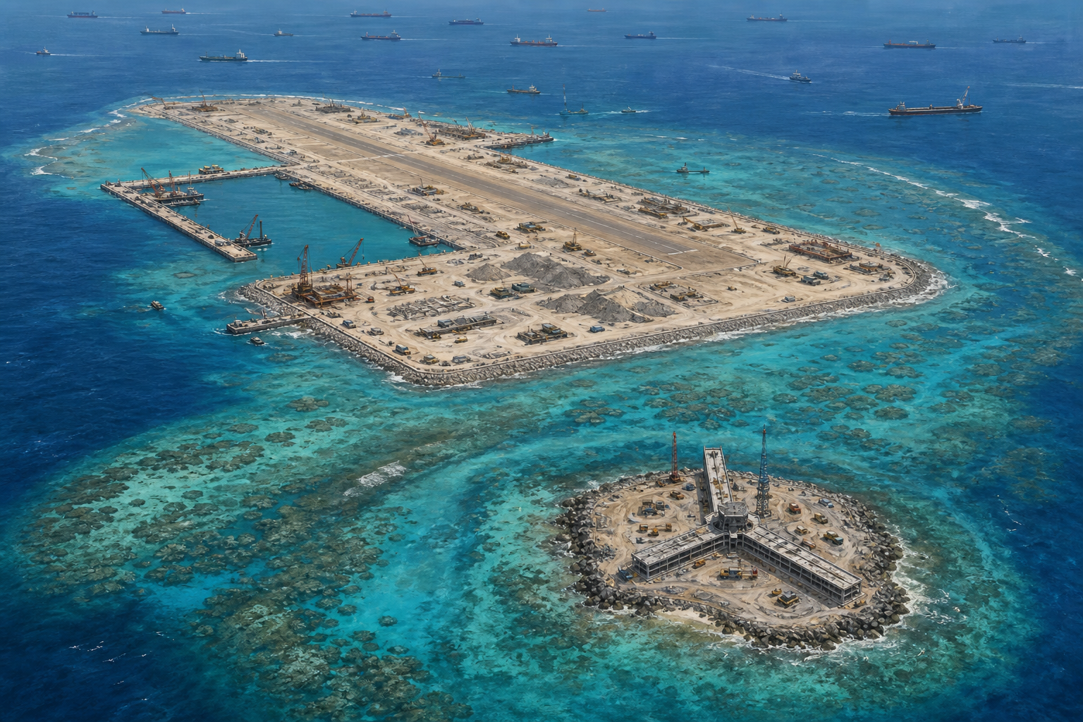
HONG KONG - New structures have appeared on a small island near China's rapidly expanding Antelope Reef project in the disputed South China Sea, according to commercial satellite imagery reviewed by Reuters, adding another potential layer to Beijing's military reach across the Paracel Islands.
The latest image, captured by satellite company Vantor on August 17, shows a three-pronged installation under construction on Yagong Island. The islet lies about 14 kilometers northeast of Antelope Reef in the Crescent Group of the western Paracels.
The purpose of the structure has not been established. Vantor said parts of it resemble radar and early-warning facilities built at other Chinese outposts in the South China Sea. Two independent security analysts told Reuters that a radar station or observation post was plausible, while stressing that the available evidence was not yet sufficient for a firm conclusion.
Construction on Yagong began in March and April, the imagery provider said. The activity is significant because of its proximity to Antelope Reef, where China has created an artificial island nearly six kilometers long with a straight stretch of coast exceeding three kilometers.
The Asia Maritime Transparency Initiative at the Center for Strategic and International Studies reported this month that dredging and landfill work at Antelope appeared complete. It measured the new landmass at 1,458 acres and identified earthworks consistent with the early stages of a runway. Work then extended about 4,300 feet along the only edge capable of accommodating an airstrip similar to those at China's other major outposts.
No runway has been completed, and no public evidence proves that Yagong's new construction is a radar facility. Those distinctions matter. Satellite shapes can support an assessment, but they do not reveal every intended use or guarantee that a project will be finished as analysts expect.
China's Defense Ministry did not respond to Reuters' request for comment. Beijing has not acknowledged building a new military base at Antelope. Chinese state media have described the development in civilian terms, including weather forecasting, fisheries protection and scientific research.
China has controlled the Paracels since seizing them from South Vietnam in 1974. Vietnam claims the entire island group. Farther south, the Spratly Islands and surrounding waters are claimed in whole or in part by several governments, including China, Vietnam, the Philippines, Malaysia, Taiwan and Brunei.
The strategic concern is not created by one building. It comes from the pattern of turning physical construction into permanent advantage before diplomacy can respond. Reclamation creates space; ports sustain ships; runways extend aircraft; radar can expand awareness. Each step can be presented as limited while the combined network changes the balance of power.
That is how control is often established in contested waters: not through one declared conquest, but through repeated facts placed on the sea. By the time neighboring states organize a protest, concrete, sensors and personnel may already be present. Reversing them then carries far greater risk than preventing the change.
A radar facility on Yagong, if confirmed, could help monitor aircraft and vessels approaching the larger Antelope installation. Combined with a future runway, it could improve China's ability to track movement through the northern South China Sea and complicate operations by the United States and regional partners in a crisis involving Vietnam, the Philippines or Taiwan.
Beijing argues that other claimants also build outposts, and Vietnam has expanded its own facilities in the Spratlys. That context should be reported. It does not erase the difference in scale, military capacity or China's ability to pressure smaller neighbors while rejecting an international ruling that undermined its broad maritime claims.
The United States and democratic partners should answer with sustained visibility rather than panic. Commercial satellite findings should be published, regional coast guards should share information, and Southeast Asian states need surveillance and maritime-law capacity. Regular lawful presence is more credible than occasional outrage after construction is complete.
Washington must also keep open channels that reduce the chance of collision. Deterrence is strongest when clear capability is matched by clear communication. The aim is not to start a conflict over concrete, but to prevent Beijing from concluding that gradual coercion is free of cost.
For now, the Yagong structure remains an assessed possibility, not a confirmed radar station. Yet secrecy itself is part of the problem. If the work is genuinely civilian, China can explain its function and permit transparent scrutiny. Silence, combined with years of militarization elsewhere, gives neighboring countries reason to prepare for the harder interpretation.
The new image is therefore less a final answer than another warning. In the South China Sea, strategic reality is being built piece by piece. Democracies and regional states cannot afford to notice only after the pieces have become a base.
Comments
Loading comments…